Survey Archives
Survey Archives are the online file system for the certain mapping in the Tax Map Office. A general description of each item is listed below:
Survey Books – These files are the indexed boundary surveys that have been prepared by professional surveyors and provided to the Tax Map Office for filing as a public record of the survey that was completed. The letter number designation refers to a survey book and page (for example, K-34) that the survey is indexed as. The index to find the survey should be noted on the Auditor’s GIS mapping of the corresponding parcel the survey was done on. The user will need to find the survey index then go to the survey archives/survey books to retrieve the survey. These files have been scanned and uploaded for easy retrieval by surveyors who may need to use them for their surveys. Owners should leave interpretation of these surveys to the professional surveyors. The tax map office reviews for compliance with standards, but the validity and content of the survey is solely upon the professional surveyor who prepared the survey.
F-Surveys – F-surveys are the same as survey books with the exception that the size of the original submitted survey was on a larger format paper that prohibited using the standard legal size the other books accepted. The “F” was reserved for only large format paper sizes.
Historical Surveys – Historical surveys are also boundary surveys prepared by professional surveyors, but they are not found in the survey book indexing format. These survey must be found by knowing the geographical location of the property (township, section and quarter section, or city/village lot number). Although most surveys are indexed, these files are useful to provide more complete research of properties.
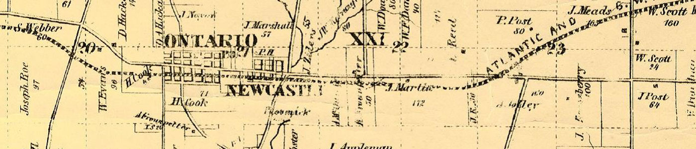
Historical Maps/Tax Maps – Made available for historic research purposes mostly, these files are scanned versions of the County Auditor’s Maps from the 1850s up until the hard copy maps were converted over to all digital in GIS around 2003. There are also various atlas maps and historical county maps covering various years.
Engineer’s Projects Map – Index map of roadway and bridge projects